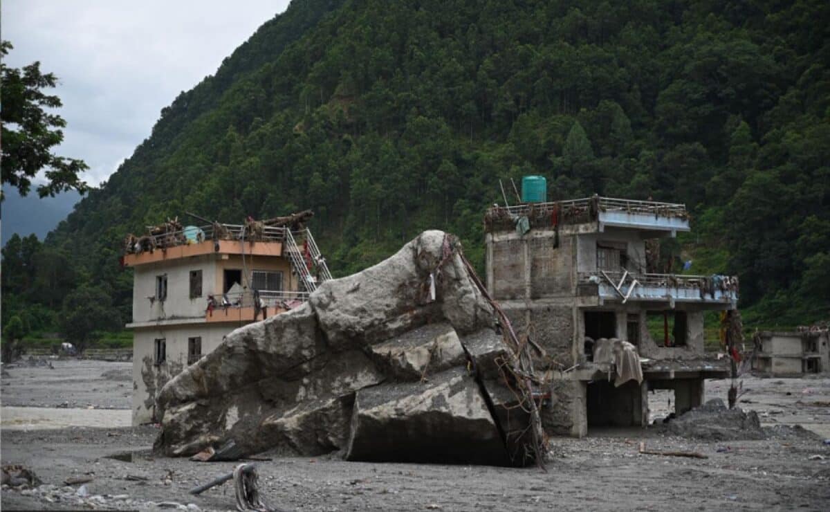

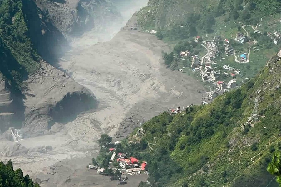
The sky was clear. No rain had fallen in two days. Then, in minutes, the Trishuli and Bhotekoshi rivers rose by up to 8 meters.
This wasn't a monsoon flood. On August 26, 2026, something else drove the water, and it changes how we should think about Himalayan travel safety.
Before we get into the science: this event killed well over a thousand people and left thousands more missing across Rasuwa, Nuwakot, Dhading, and neighboring districts. Recovery efforts are still ongoing. What follows is a plain-language breakdown of the cause, written for travelers who want facts, not headlines.
Anatomy of a Clear-Sky Flood
Most floods in Nepal happen during the monsoon. Heavy rain fills rivers over hours or days. That's not what happened here.
The trigger was heat, not water.
High in the mountains, average temperatures have been climbing. Rock and ice on steep slopes rely on cold to stay locked in place. Freezing and thawing cycles bind loose rock to bedrock. Glacier ice bonds to the slope beneath it.
When temperatures rise for long enough, that bond weakens. Rock that held for centuries starts to slip.
On the morning of August 26, a large section of rock, soil, and ice broke away from the Langtang Lirung massif, near the Nepal-China border. Investigators believe the mass gave way gradually over roughly a day before the final collapse. There was no earthquake to blame and no storm overhead. Just heat, gravity, and a slope that had held together for a long time.
This is what scientists mean by a "clear-sky flood." No rainfall. No storm system. The hazard comes from above the valley, not from the atmosphere.
The High-Speed Debris Flow
The falling mass didn't reach the main river right away. It landed first in a smaller tributary stream high in the mountains, blocking it completely. For several hours, water built up behind this new, unstable dam.
Natural dams like this rarely last. Made of loose rock, ice, and mud, they can't hold back much pressure.
This one broke early on August 26, sending a surge of water, mud, ice, and boulders down the valley. The debris-heavy flow moved fast, some estimates put it above 150 kilometers per hour through the upper gorges. The narrow valley walls squeezed and accelerated it further downstream.
This chain of events, a mass collapse blocking a river, followed by a sudden dam break, is the mechanism behind a glacial lake outburst flood, or GLOF. It's one of the most studied hazards in high-altitude regions worldwide, and one that's becoming more frequent as glaciers retreat and mountain temperatures rise.
The New Reality of Himalayan Travel
For travelers, the most important distinction right now is this: the danger is to river-valley infrastructure, not to high mountain trails.
The flood tore through the Bhotekoshi-Trishuli corridor, destroying bridges and stretches of highway between Kathmandu and Rasuwagadhi, including sections near Betrawati and Trishuli Bazaar. That's the route many travelers use to reach Syabrubesi, the usual starting point for Langtang Valley treks.
Here's what that means in practice this autumn:
Langtang Valley trekking is possible again but requires a detour. With the direct route through Syabrubesi disrupted, travelers are being rerouted through Bidur and Dunche, adding at least a day to the journey.
Manaslu Circuit access is harder to plan around. The Malekhu-Dhading bridge, a key access point, was damaged, and public transport on that route isn't running normally. Check current status before booking.
Trails at altitude were largely untouched. The collapse and flood stayed within the river valley. Once you're above the damaged infrastructure, trekking conditions haven't fundamentally changed.
The practical challenge this season isn't trail safety. It's highway connectivity. Plan for longer transit times, book flexible transport where possible, and confirm road status close to your travel dates rather than relying on pre-flood route information.
Stay Ahead of the Next Update
Conditions on these routes are changing week to week as repairs continue. If you're planning autumn travel in Nepal, join our email list for real-time travel alerts and local trekking guides, so you're working from current information, not last month's news.